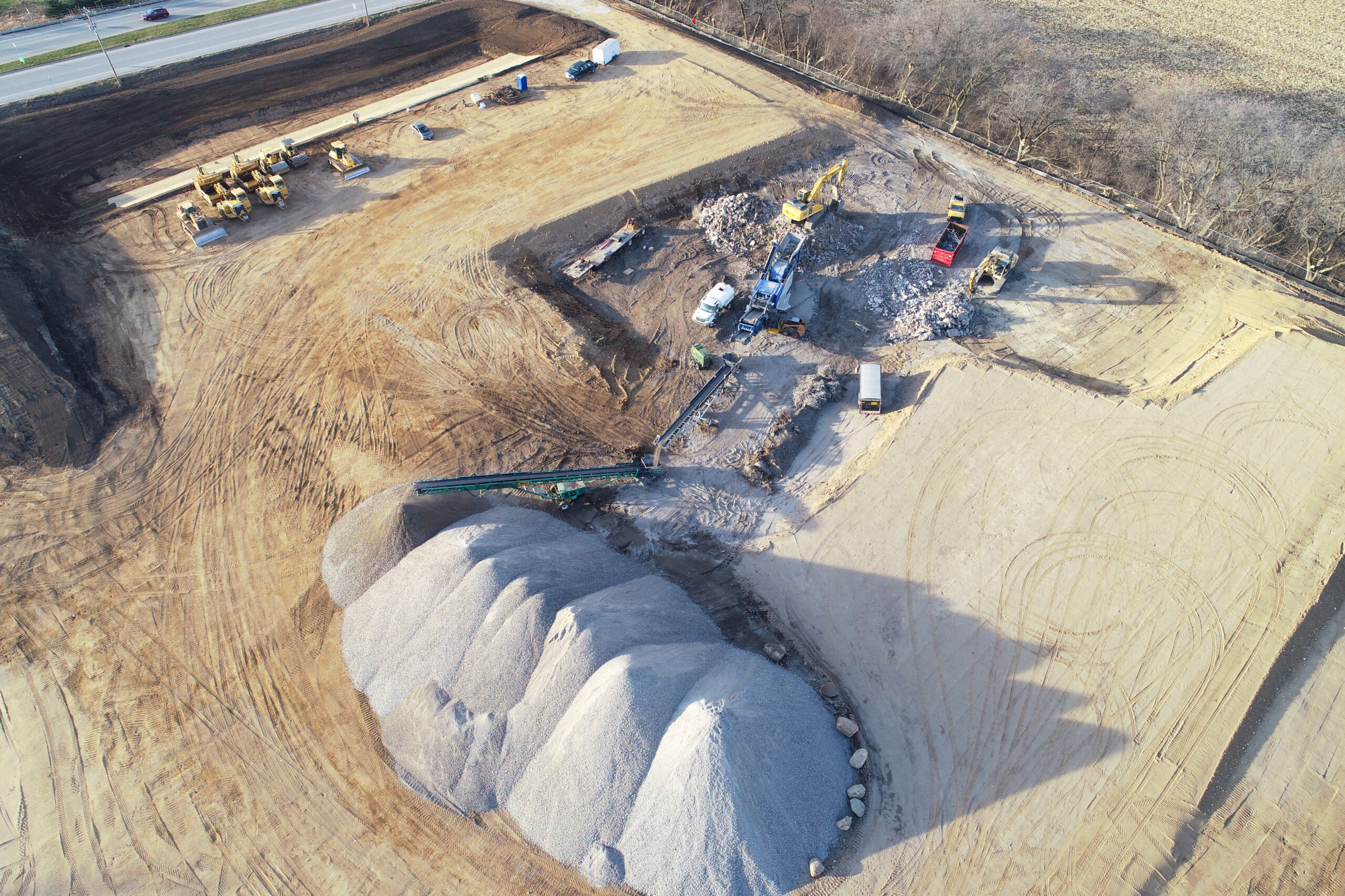
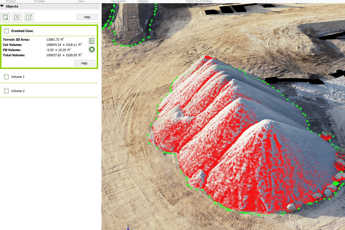
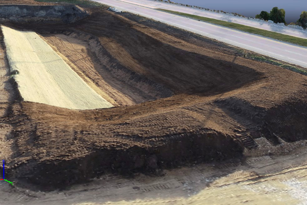
At NBG, we utilize the latest drone technology to enhance our surveying capabilities and improve project efficiency. High-resolution images captured by drones are processed using Pix4D software, generating accurate, up-to-date topographic models of our job sites. This real-time data allows us to analyze earthwork quantities with precision as projects progress, ensuring informed decision-making and optimized operations.
One practical example of this technology in action is tracking stockpiles—such as crushed concrete—by utilizing drone-generated data. This approach streamlines measurement processes, improves material management, and enhances overall project oversight.
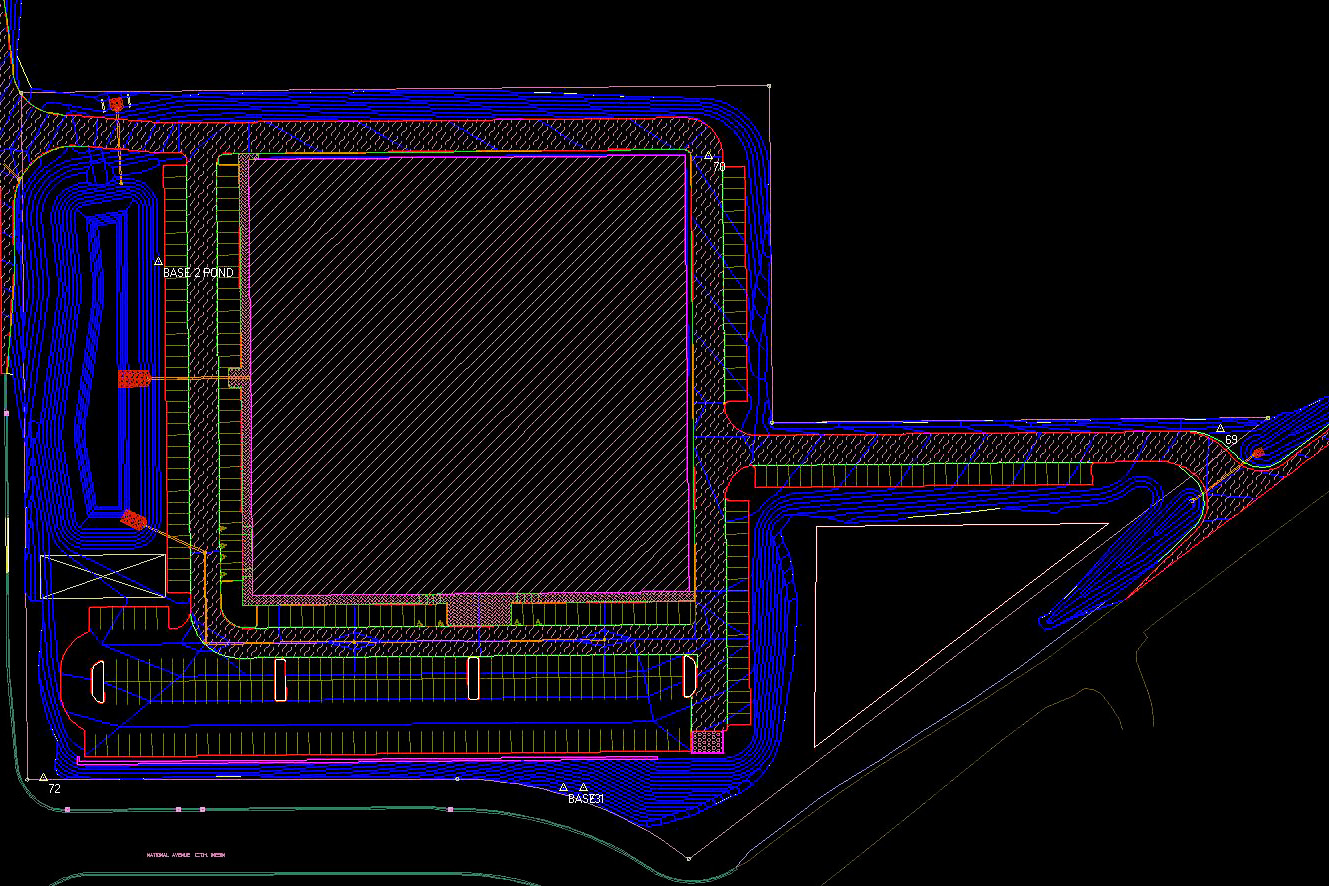
3D Modeling
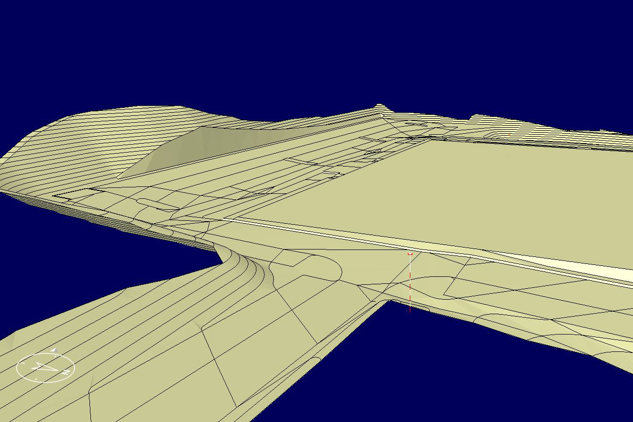
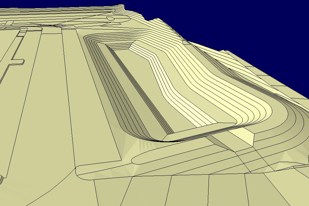
At NBG, technology drives efficiency from the very first step. During the bidding process, we utilize Agtek Earthwork software to develop 3D models, accurately determining earthwork quantities from PDF and CAD drawings. This allows us to generate precise estimates and deliver reliable projections.
Once a project is awarded, we refine the details further by constructing a comprehensive 3D Grading Model using CAD drawings. This process not only ensures precision but also helps identify and resolve any plan inconsistencies early on—streamlining operations and enhancing efficiency before ground is even broken.
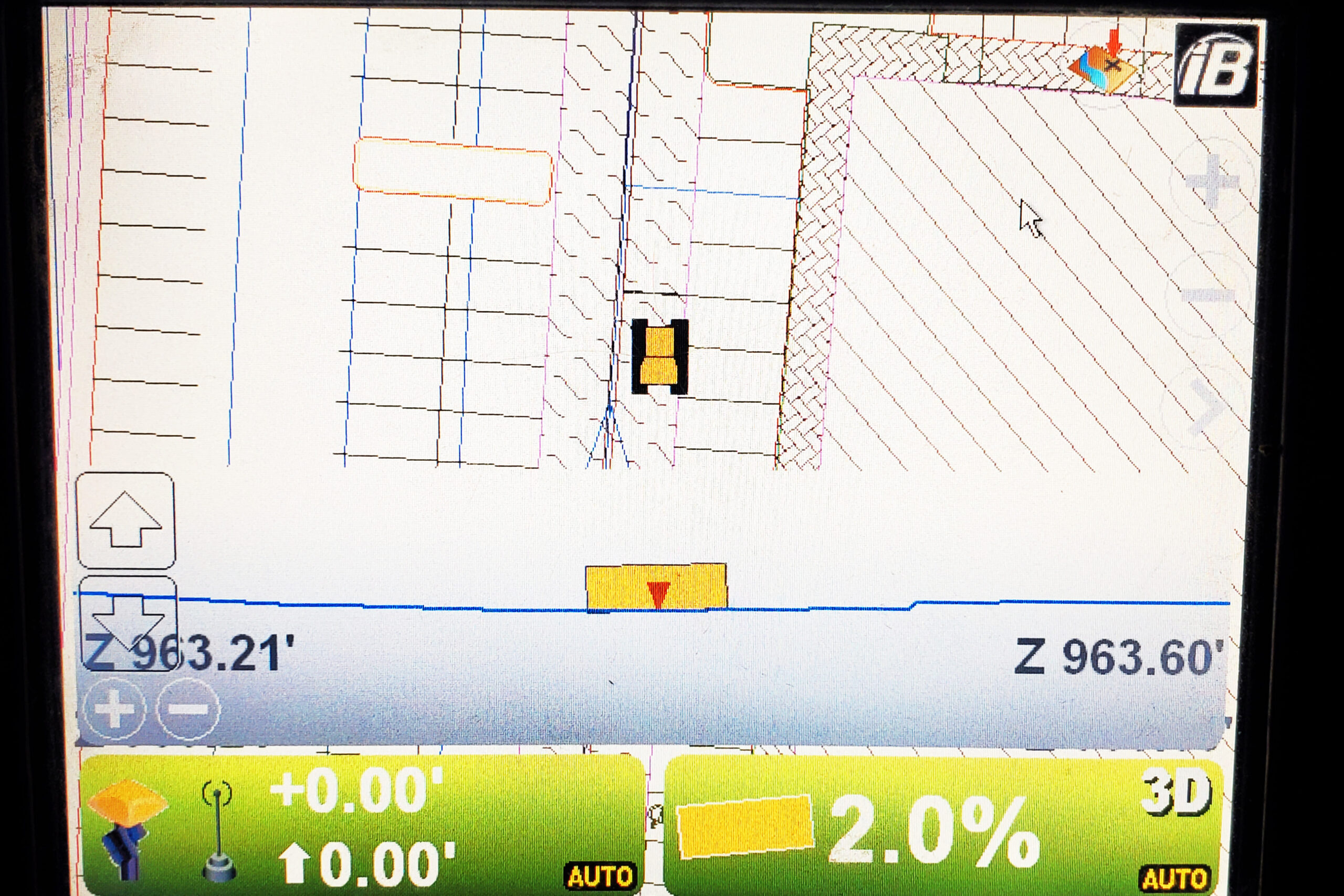
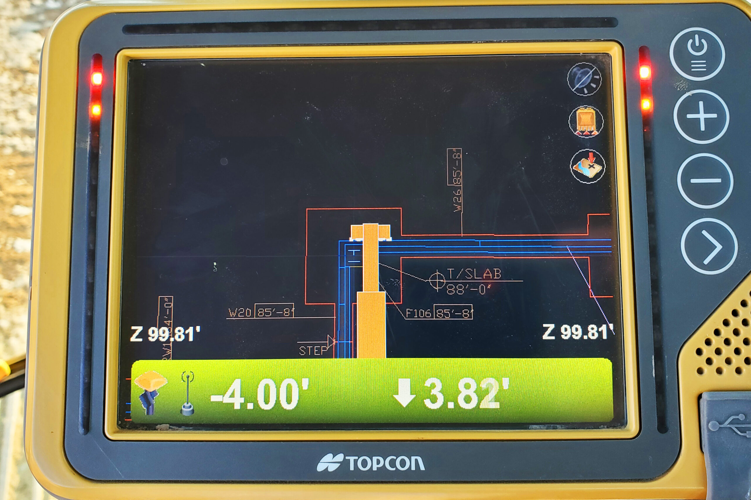
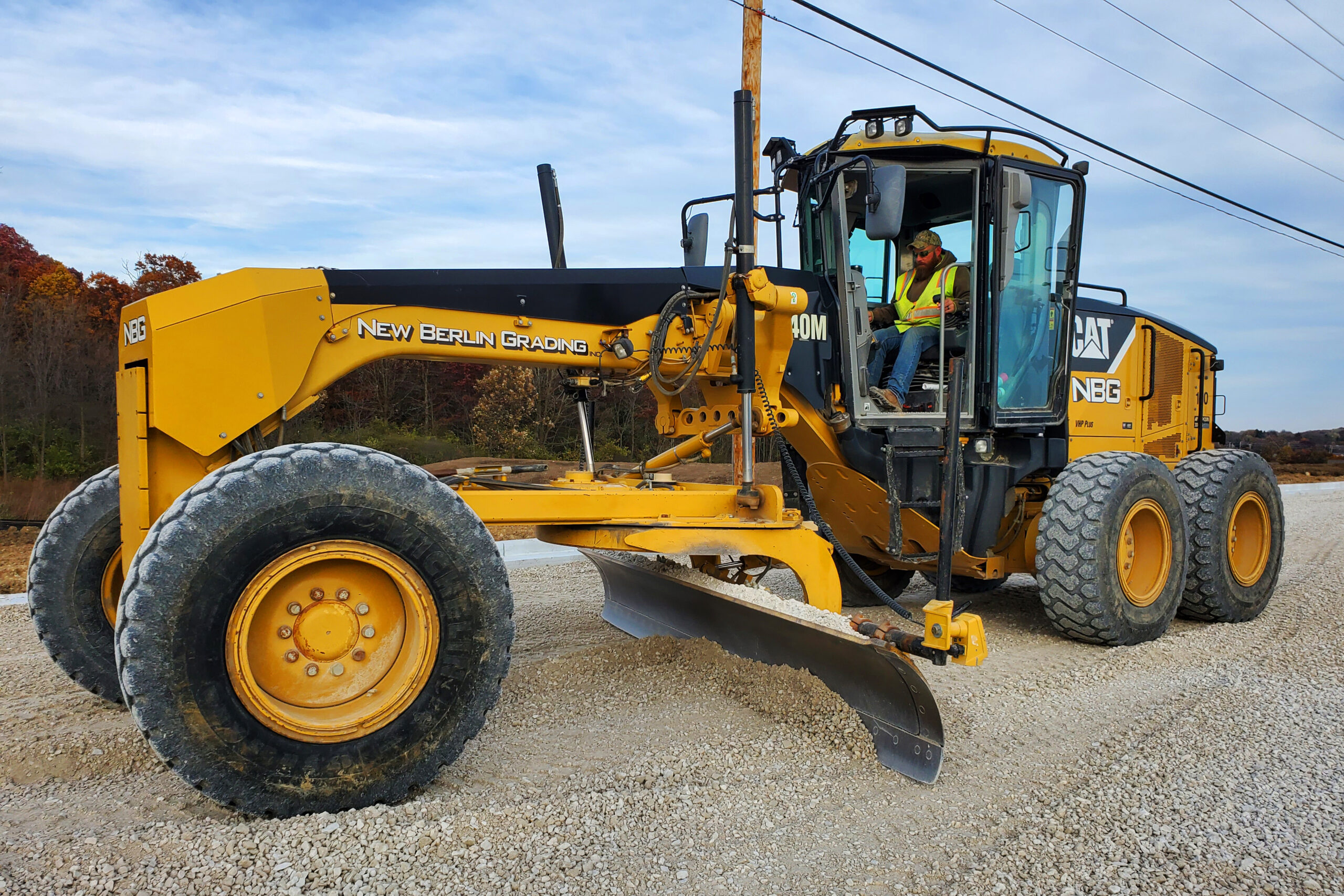
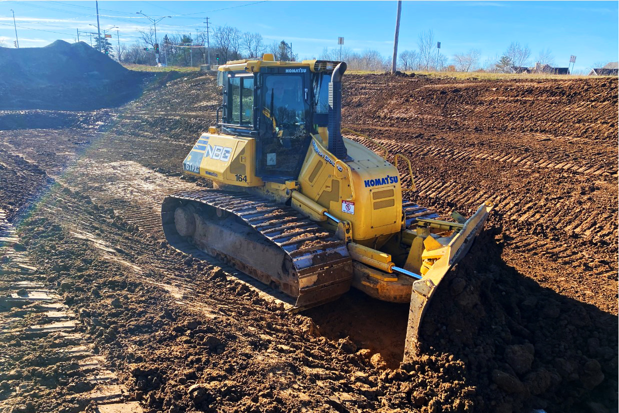
GPS Machine Control
NBG uses advanced Topcon GPS Grading Systems across our fleet of bulldozers, graders, and excavators to ensure accuracy and efficiency in site grading. By uploading 3D models into our machines, the GPS system provides real-time data on cut and fill measurements, automatically adjusting blade elevation and cross-slope for precise results. NBG delivers high-quality grading solutions tailored to each project’s unique requirements.
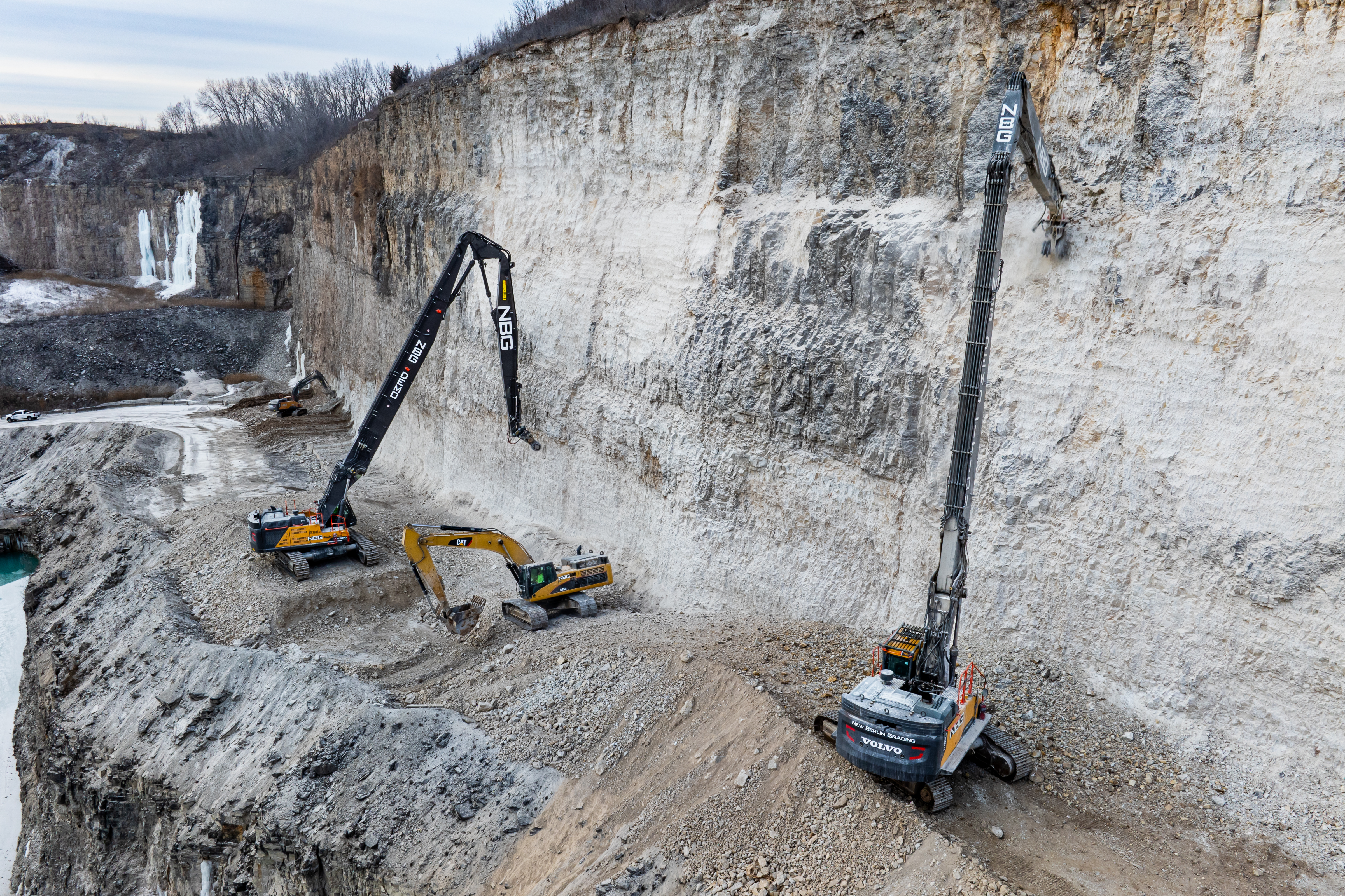
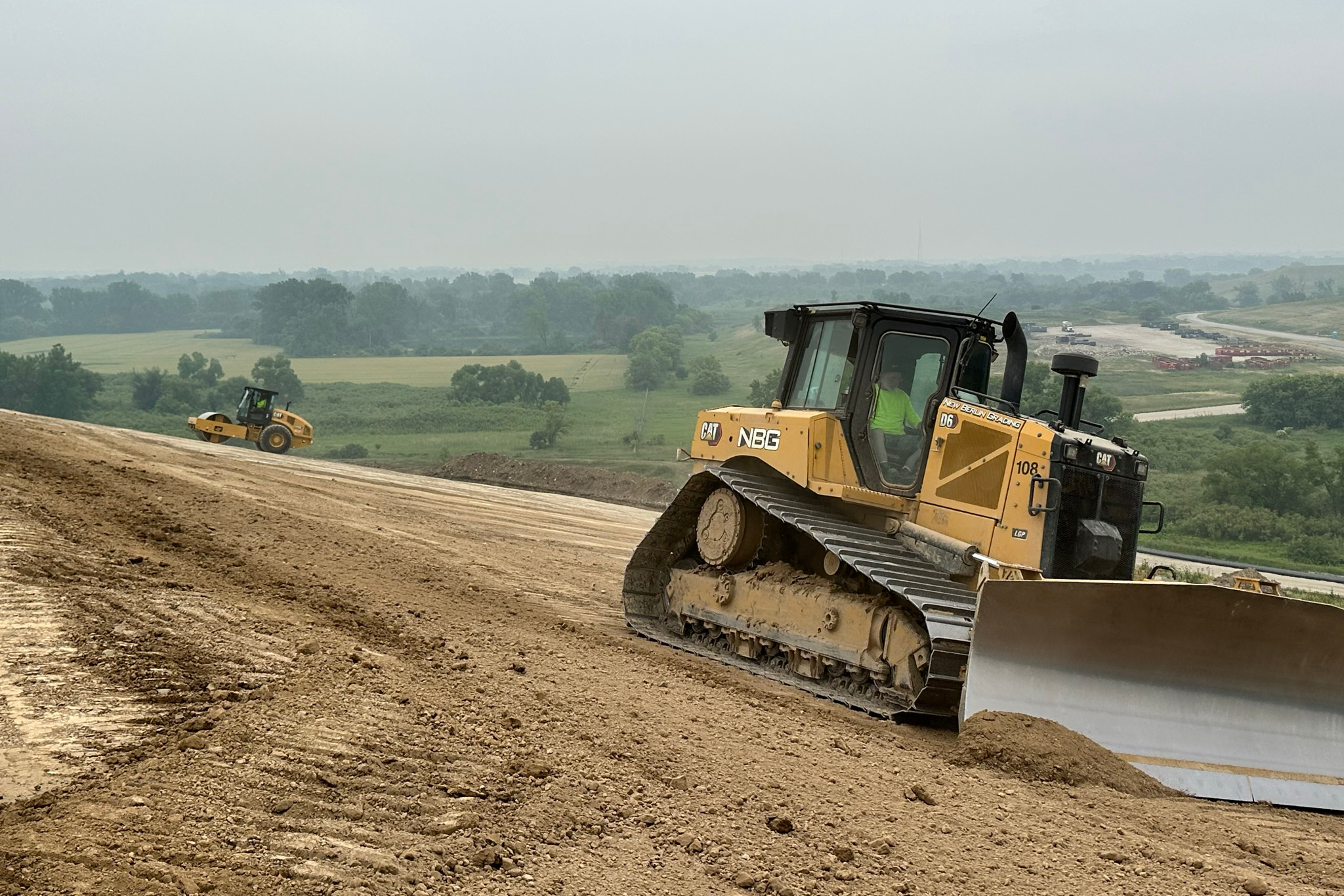
State of the Art Heavy Equipment
NBG operates a diverse fleet of heavy equipment, ensuring we have the right machinery for every earthwork and demolition challenge. As part of our commitment to efficiency and precision, we continuously upgrade our equipment and invest in cutting-edge technology to stay ahead in the industry.
One of our latest addictions is the Volvo 750 High-Reach Excavator—one of only a few in the Midwest. This specialized machine enhances our demolition capabilities, allowing us to safely and effectively take down large structures with maximum control. By integrating advanced equipment into our fleet, we provide industry-leading solutions that optimize safety, productivity, and project execution.